
A strong cold front is expected to hit North Carolina this weekend, bringing some of the coldest temperatures of the season next week.
Despite the fact that it is early, different forecast models predict at least two days of snow or other wintry precipitation in Raleigh and the Triangle next week.
How cold will it be?
Rain is expected across much of central North Carolina on Saturday and possibly into Sunday as a front approaches from the Great Plains. Forecasters predict that the cold front will arrive by Sunday night, bringing noticeably colder temperatures on Monday and especially Tuesday.
The National Weather Service provides the following temperature ranges:
Sunday night: A low of 22 degrees
Monday : A high of 36 degrees and a low of 14 degrees
Tuesday: A high of 29 degrees, compared to an average high of around 51 degrees for this time of year.
When is the next chance of snow?
As of Wednesday, Jan. 15, the Weather Service’s local forecasts for the central part of the state indicate “limited opportunities for (very) minimal snowfall.” Those are for late Friday night before the rain arrives on Saturday, when temperatures will only be cold enough for snow in the Triad, around Greensboro.
The Weather Service forecasts a second small chance on Sunday night as precipitation ends and colder air moves in. In either case, forecasters predict that any accumulation will be minimal.
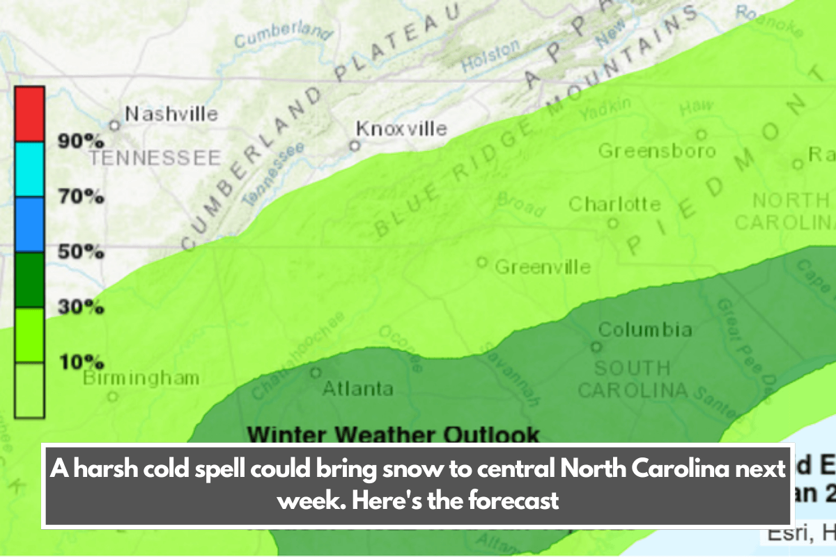
However, the National Oceanic and Atmospheric Administration’s Weather Prediction Centre forecast map shows up to a 30% chance of at least a quarter-inch of snow and sleet across all of North Carolina Tuesday and Wednesday, with a 50% chance in a section of the southeastern Coastal Plain.
The Accuweather forecast also predicts sleet and freezing rain for next Friday night, which falls outside the National Weather Service’s seven-day forecast.
When will we know?
As always, forecasters say that for central and eastern North Carolina to receive snow or other winter precipitation, we need a combination of cold air and moisture, which typically come from different sources.
The cold air is coming from the plains; the question is whether a low-pressure system will form in the Gulf of Mexico, as some models predict, and then move into the Southeastern United States, bringing moisture.